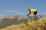
Top Trail Bike Rides
- Rio Grande Trail - This trail begins behind the Post Office on Puppy Smith Street. The first 2 miles are paved. The trail then crosses Cemetery Lane, becoming a dirt trail at that point. The trail proceeds northwest to Woody Creek.
- Hunter Creek/Hunter Valley - The trail begins on Lone Pine Road, just to the east of the Community Center. The trail is accessible to mountain bikes only up to the Wilderness Boundary.
- Sunnyside Trail - The trail begins on Cemetery Lane. Follow Cemetery Lane from Hwy 82 where the road crosses the Roaring Fork River. Approximately .25 mile beyond this point, you will see the trail beginning on the right.
- Brush Creek/Government Trail - The trail begins behind the tennis courts on Maroon Creek Road. It crosses Buttermilk Mountain and finishes in Snowmass. As this trail crosses private property, it is VERY important that bikers stay on the trail only. Failure to do so could jeopardize future use of this trail.
|
Top Road Bike Rides
Easier Rides:
- Ute Ave Trail - This trail begins on Ute Avenue near the Glory Hole Park. It runs past the Ute Cemetery and the Ute Children's Park, crossing the Roaring Fork River, winding past the Aspen Club, and finishing on Hwy 82 east of Aspen.
- High School Trail - Just west of the Castle Creek bridge on Hwy 82, an underpass access on the right will take you to the south side of Hwy 82. This trail will take you to Maroon Creek Road and on to the High School.
- Golf Course Trail - The trail begins at the corner of Hwy 82 and Cemetery Lane just west of town. It winds along the edge of the golf course out to the Aspen Airport Business Center.
- Owl Creek Road - The trail begins at the intersection of Owl Creek Road and Hwy 82 northwest of Aspen. It follows Owl Creek Road to Snowmass. As you approach Snowmass, the bike path ends, diverting bikes back onto the road
Difficult:
- Highway 82 East (Independence Pass) - Heading east from Aspen on Hwy 82, the road climbs to the top of Independence Pass (12,095 feet). The trip to the top is approximately 20 miles, passing the ghost town of Independence on the way. Please be extremely careful as this road is very narrow and has heavy car use in the summer.
- Ashcroft - Follow Hwy 82 west from Aspen. Go to the roundabout and take the Castle Creek Road exit. About 11 miles up on the left lies the ghost town of Ashcroft. The road remains paved for about 1.5 miles beyond that point.
- Maroon Bells - This road begins west of town on Hwy 82 at the second traffic light out of town. The road takes you a distance of approximately 10 miles to the beautiful Maroon Bells.
|
